The Platform Is Built to Stay Dry. The Towns Behind It Have Flooded Every Year.
San Miguel's Bulacan airport rises on 2,500 hectares of coast. Scientists and dozens of people's organizations say reclamation worsens flooding; the developer says it's the fix. The wet season keeps drowning 23 towns.

Before the fill trucks arrived, that stretch of Bulacan coast was doing quiet work. Low-lying flats along Manila Bay absorbed storm surge and held rainwater that would otherwise pour into Obando, Meycauayan, and the towns hugging the shoreline. Now a 2,500-hectare platform for the New Manila International Airport sits on it, and the question scientists and residents keep asking is where that water goes instead.
The airport is a San Miguel Corporation project, developed and financed through San Miguel Aerocity Inc. under a build-operate-transfer concession with the government, built at no cost to the state and funded off SMC's own multi-billion-dollar corporate loan facility. The best-documented contractor role is Dutch dredger Royal Boskalis Westminster. It is a private Philippine megaproject, not a PRC-financed one, and that distinction matters because the accountability line runs to a Manila boardroom, not an offshore lender.
Who signed the water math
Every coastal project this size runs on assumptions filed on paper. The DENR's Environmental Management Bureau–Central Luzon issued the Environmental Compliance Certificate to San Miguel Aerocity on June 1, 2021, with a copy made public that June, following an earlier 2019 certificate covering land development. That permit says the modeled drainage should hold under the storms the modelers chose to run. A clean certificate is a bet, not a guarantee. It does not read the wet season, which tests the dikes and pumps against the rain that actually falls.
Whether that certificate approved specific pumping capacity or dike heights is not something the public record spells out, and that opacity is the point. The paper trail names an approving bureau and a developer. It does not hand ordinary Bulakeños the numbers they would need to check the bet for themselves.
Reclamation or recovered fishpond
Even the ground is contested. San Miguel's own position, stated by SMC president Ramon Ang, is that the site was pre-titled land that sank over time and was converted into fishponds. DENR Secretary Maria Antonia Yulo-Loyzaga, for her part, said in August 2023 that the department keeps monitoring the airport's compliance with environmental laws 'even if it is not a reclamation project.'
Scientists and community groups read it differently. They call the coastal platform reclamation in effect, arguing that raising 2,500 hectares pushes runoff and tidal backflow toward towns that flooded before a single truck of fill arrived. Both readings cannot be casually true, which is exactly why the label is worth fighting over.
Who inherits the overflow
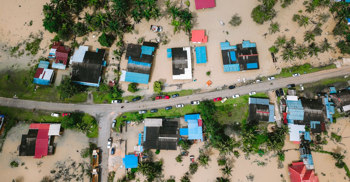
The late-August 2026 floods put the platform back under scrutiny. Bulacan went under a province-wide state of calamity on Aug. 17, with provincial officials reporting floodwater reaching about 1.35 meters and hitting roughly 278,000 families, close to 960,000 people; the Central Luzon monsoon death toll stood at 31 by the end of the month. On Aug. 31, National Heroes Day, residents marched under 'Kilos Bulacan' from Malolos to the Provincial Capitol, close to 600 of them from about 30 people's organizations. Inquirer put the roster at 34 organizations demanding action on flooding across 23 towns and cities and an end to reclamation projects.
At a Sept. 1 news conference in Bulakan, Ang said the flooding came from low-lying elevation, narrow and winding rivers, and low bridges, not from the airport, and said gauges in rivers near the site showed water levels were not high. San Miguel Aerocity added in a separate statement that the project did not cause Bulacan's flooding and that it includes long-term flood mitigation measures. The airport was still years from partial operation when residents marched, which is their whole complaint: the water is already this bad before a single runway opens.
So watch what the platform does to the water long before it clears its first flight. Watch whether the towns behind it flood higher as the fill rises, and watch who gets told to evacuate. SMC will measure this project in construction milestones. The families in Obando and Meycauayan measure it in how high the water reached this August, and in whether anyone with a signature on the plans answers when it climbs higher next year.